Sunday, September 17, 2017

The Confluence

Confluence

I was getting frustrated. I'd been wandering around the Grand View Point rim section of the Island in the Sky for the better part of 50 minutes, trying to find the abandoned and so called"Government Trail" that provided the only non-roped descent access through the vertical walls to the White Rim Rd 2000' below. Not to mention within 2 minutes of leaving the parking lot I'd ripped my semi-new green Mojo shorts on a lone tree that looked relatively benign. I was going on some vague directions via map and pictures given by various online sources, the main one being Buzz Burrell's Quad Trek post. They had good pictures from below, but that wasn't helping me up on the rim. I'd thought it be relatively easy to find, seeing as its the only possible option for miles. Finally I decided I needed to go farther out on the rim and sure enough, found it within a few minutes. For others reference, from the Grand View point overlook, follow the 1 mile rim trail for about 5-7 minutes(walking). Bust out to the rim and start walking till you see a cleft in the rim that heads back towards the parking lot(east). This is the entrance.

The goal for today was to descend the Government Trail to the White Rim Rd, run the road to White Crack Campground, take the abandoned White Crack Jeep trail(lots of abandonment on this run) to an old miners camp near Stove Canyon, then cross country it to the confluence overlook of the Green and Colorado Rivers. Easy.

The sneaky route from the Island in the Sky is somewhat similar to the Lady Peak Trail in Zion, a once well used and fantastic route that due to liability has been taken off the NPS propaganda. Probably for good reason. The route is marked with cairns once you get down a little ways. Mostly 3rd with some 4th class terrain winds it way down through the shelves. Pretty amazing little find by whoever did it first. There are a few sections that are sandy and gritty, which make them a little more captivating. No rope work though.

Entrance. You can see the parking lot upper left corner 

Route through the cliff band

Government sponsored foot hold


From Grand View Point Lookout

After only 10 minutes I was down through the cliffs and it looked like a straight shot through a few miles of talus and desert washes to the road. Unfortunately, two smaller cliff bands inhibit the path. The first is easily avoided by heading descenders right. The second is a little more difficult. I was lucky and found a nice little 5.5 downclimb that saved me a bunch of time, as it appeared otherwise a long circumventing to the west would be required.

5.5 climb I found through lower vertical cliff band
After only 40 minutes from the rim(minus my initial wandering) I was running towards white crack. A scenic but rather boring 3-4 miles on the road landed me at the White Crack Campground. From here, old miners have blasted(NPS route all require dynamite) a cleft through the actual White Rim that leads in a very non-direct 5.5 mile fashion out to Stove Canyon, an exit point for those on the Green River prior to the confluence. An old Miners camp is there, with all that's left being a couple old rusted metal beds among other ancient tools. This old jeep rd is now more of a trail, marked by cairns that otherwise would often not be easy to follow as years of overgrowth and rockfall has made it less than buffed out singletrack.
Add caption

Rain allowed for lots of head dunks and free refills

The white crack entrance 
The view from the White Crack Trail. This is why trails are important

They were probably comfy at one point. Miners camp overlooking Green River

From here it was a 2 mile GPS-utilized cross country obstacle course through cactus and slick rock to the confluence overlook.  Various cairns were found intermittently along the journey but I always seem to lose them and had to trust my own instincts(not very effective). Eventually after 3.5 hours from leaving the rim I arrived at my destination. It was beautiful, but somewhat anticlimatic as both rivers are pretty ugly, a poo brown. Not exactly majestic. However, the fact that I was 16 miles from the nearest paved road in a very inaccessible part of the park made for a very calm and peaceful, but serious experience. A broken leg out here wouldn't be a good idea.

Reversing the route was much easier as all the route finding had already been done. I shaved off a few miles and at some time despite being tired and having the steep climb back up to the rim. All in all it was a great day in what I often consider my favorite national park. 32 miles with 5600' of vert.

Canyonlands.

Monument Basin with standing rock visible 

Sunday, August 27, 2017

Hamburgerized Feet on the Highline


Beautiful Scenery early on the Highline


The Highline trail(025) runs the length of the Uintah Mountains from east to west or vice versa. I believe it's much more popular among the backpacker crowd than the IAD ultrarunning crew, but maybe that's just standard for most >26 mile distances. After Court ran it several years ago while I was in Florida and hearing his bold claims of it "being the hardest thing I've done in my life", well how could I not want to try it? Davy Crockett seems to have put the single push effort on the radar with his first attempt back in the late 2000's. Many have since run it with the FKT being somewhere in the 25.5 hour range. Surprising since the Highline's stats are seemingly puny as compared to many 100 milers, being only 78-80 miles with 14k vert. Heck, Hardrock is 20 miles further with twice the vert and 25.5 hours was the 3rd place time this year. I ran the Bear and Wasatch 100's with similar times.

It didn't take very long for me to realize why this is the case.

The 2nd biggest hurdle to completing the Highline after actually running it is the shuttling. The start(most run east to west) is at the Leidy Peak TH which is about an hour from Vernal on a dirt road, seemingly as close to nowhere as possible. The end is at the Hayden Pass/Peak TH which is up the Mirror Lake highway, which while much more accessible and popular, is still 5 hours away regardless of which Mapquest route you choose. The only real option you have is to beg or pay a friend, spouse, or hitchhiker to shuttle you as the logistics of doing it as runners alone is really quite burdensome. Luckily I have such a wonderperson in Annie. Steve and Shane, my co-runners, also had angels in the form of Pete and Vince. Thanks to you people. May Hoka money fall from the sky upon you.

The three of us departed from the Leidy Peak TH at mile 0 at around 6:40am. We had of course the number one goal of finishing, second goal of FKT, and third goal of sub 24. I personally didn't think either of the 2nd/3rd were possible based on our lack of fitness, the number of solid folks who have tried, and weather etc. We quickly realized what we had read about the Highline trail and what it entails:
1. There is often no obvious trail, only large cairns or tree blazes, with an occasional sign. This presents two challenges: the lack of runnable trail and navigation. While I will say that we really had no trouble with navigation thanks to the Gaia GPS app, its impossible to not be slowed by the rough terrain. Night navigation is much more difficult and doing it solo would be a huge mental drain. And when there is a "trail", its likely the worst trail you've ever encountered. I've seen Spartan Trail Races with less obstacles. Trails serve a couple purposes, one is to get you from point A to B, the other is to do so more efficiently than if you did it sans trail. The Highline only manages to accomplish the first.
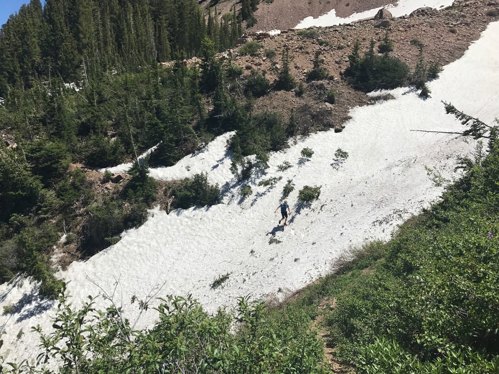
2. Marshes: As if the lack of trail wasn't tough enough, then the Highline Gods throw giant wet marshes at you that are basically unavoidable. One went up to my knees. Then there are the 500 creek crossings. This creates not only slow progress but wet foot skin destruction, which would be my downfall.
3. Weather: Davy Crockett made some comment about how he wouldn't attempt to run the Highline again if there were any chance of thunderstorms. So he is basically saying he is never going to run the Highline again. 20-30% chance of thunderstorms is the norm up there. Best to get that in your head.
4. Lack of support: Honestly for me this was the best case scenario. The complete lack of support options means you can't bail, or if you do, it will be worse than finishing. The nearest road at any point is at least 16 miles away, and if your shuttling angel is expecting you at Hayden, they won't be pleased to hear they have to drive back 3.5 hours to some other random TH to get you. The commitment factor was key for me as it almost guaranteed a finish, barring a broken femur, where as in other 100 milers practically every aid station is a mental battle to not quit. On the Highline, there is no quitting because there is no one to help you do so.

We ran/walked/hiked for about 10 hours across some really beautiful terrain, basically alone minus a few backpackers and some SAR folks looking for an 80 year old guy who had been missing for a week. We crossed several passes, the largest being North Pole. I think we were all doing ok until somewhere around mile 40 near Anderson Pass when we realized we were only halfway, tired, and it was starting to rain consistently and darkness was approaching. I became significantly mentally broken here but managed to become revitalized with the first of 3 Taco bell $1 burritos. Amazing really. The rain and wind kept their barrage up for around 3-4 hours until we hit Porcupine Pass at dusk and dawned the headlamps. We were lucky the weather wasn't any worse.
The start 

Early Tundra running

One of 900 named lakes I don't remember

heading up to North Pole Pass

This is not representative of the quality of the trail. It looks good here

Better representation. Much rockier 

Excellent example of the trail. Where is it? Exactly 

Here comes the rain. Heading to Anderson. All of the running is staged. -"Hey Shane, act like you're running". -"Ok". 

Running down Anderson into Gorgeous Yellowstone Basin

Yellowstone to Tungsten Pass

The weather continues. Tungsten Lake 

Odd evening colors up to porcupine pass


The course from Porcupine to Red Knob is really long, and doing it in the wee hours of the morning made it seem even longer. Court had mentioned he had gotten lost on Red Knob and sure enough, Steve's GPS track took him and Shane too far to the right. We were able to correct w/o too much hassle. We were all surprised at how warm it was too. We had all prepared for a pretty cold night but Shane didn't even use his coat for a lot of the evening. The Highline Gods took mercy on us.

Crossing over Red Knob and down to Dead Horse Lake around 1-2 am was probably the low point for the three of us. Steve and Shane were moving much better than I. My feet had been wet all day and now that the sun was no longer present, they weren't drying. I was beginning to feel the blisters forming. How the other two managed to salvage their feet may have something to do with their gators or shoe stack heights. Or they failed to fall into the rivers 15 times.

We made it over Dead Horse Pass and then down to Trail Creek, which was by far the worst trail of the entire day. Steep, loose, terrible footing. We tried not to complain but failed. We finally told Shane to ditch us at dawn so he had a chance at beating the FKT. Steve and I crested the last pass of Rocky Seas right at the 24 hour mark with 8.5 miles to go. Theoretically this mileage with 1.5 hours to go would be a cinch with a nice trail, healthy feet, and fresh legs. Alas, none of those were to be found. I slogged it out in 3 hours with what has to have been the longest 8 miles of my life. I've had some really bad finishes where I wanted nothing more than the parking lot to show up, such as on the Grand Teton or Bear 100. They all paled in comparison to the pain and suffering I felt in my feet those last 8 miles. I honestly don't know my official finishing time, but its somewhere close to 27  hours.
Crappy photo of sunrise from Rocky Sea pass

After finally arriving at the TH and removing my shoes, it became apparent why it felt like glass shards were cutting me on every step. I had 3-4 large longitudinal fissures running down both my feet, with 12 separate blisters and what was obviously trench foot like skin. One week later and I am still suffering the aftereffects of this horrid hamburgization. If I had one piece of advice it would be to avoid getting your feet wet at all costs.
They felt worse then they look 

This is what eternal hell must feel like 

Despite the obvious pain, this was a significantly rewarding experience. I proved to myself that I can do a long, difficult trail run unsupported, and it was spectacular, secluded mountain terrain. Davy suggests the Highline is as difficult as any mountain hundred, and I'd have to agree for the reasons I stated above. It is not to be taken lightly. Doing it with good friends is key. Solo I can see how much more difficult it would be.

Big congrats to Shane for snaking the FKT by 3 minutes! Now that's just cruel. Travis and Bret have to be a bit erked by that one. Sorry guys, it was my fault. He could have broken it by at least an hour if he wasn't so nice and waited around for my sorry butt. I also believe a sub 24 finish is not that far away. Just needs the right person, ahem, Jared Campbell.

Other info: Drank 100% unpurified water w/o regard to its source. As Shane will attest, every water source looked "perfect". Steve got giardia several years ago from Henry's Fork, but I've never had any issues. Purifying takes too long and Flagyl is cheap. As Court said, "if you aren't willing to drink straight from the source, you aren't meant to be on the Highline". Take it has you may. Ultimately I highly recommend this as a bucket list run for those so interested. It may take a week or two off your life like it did mine, but its definitely a gem.

Final thoughts: must do:
-later in the season is better despite lack of daylight as the wetness will destroy you.
-Plan on weather, bring wet/warm stuff
-GPS is essential. Screw paper maps. Get the Gaia. It will save your bacon.
-Bring bacon
- Dry socks. Dry socks. Bring 3 pairs.
- Bring a fun, optimistic friend. Or an ipod.


Sunday, August 13, 2017

Trans La Sal


One of only 2 signs I saw that actually mentioned "Trans La Sal" 

In today's ultrarunning community, there are a handful of "classic" traverses or adventure runs that run across or through the best of the national parks or forests. R2R2R, Zion, Teton Crest, Bryce, etc. These are all fantastic traverses in their own individual way. Most ultra-runners worth their beans have heard of most of these by now, if not attempted them. There also exists a plethora of other traverses than incorporate off-trail terrain, with lots of 3rd/4th or even 5th class terrain that may not appeal to the standard ultra-runner, like Nolans, WURL, or other peakbagging sagas. Two years ago I set out with good old Steve and Court to bag all the 12k' peaks in the La Sals, which was a spectacular day in the mountains, despite us failing to navigate our return journey correctly. This prompted me to do some more research about the trail systems through the La Sals.

 One such pure trail run that I was not aware of until moving to Moab a month ago was the Trans La Sal trail. This obscure route was created many years ago, but either never really caught on or has purposefully been kept a secret by those in the know, maybe like the Zion Traverse was 10 years ago. There isn't much info on the internet about it, other than the CalTopo link I'll share below. The La Sals seem to be somewhat of a hidden gem mountain range, nested between the uber popular Wasatch and San Juans.

The route is completely logical, without any contrivances or pavement to link the trails together. In fact, there is no pavement anywhere on the route and very little non-singletrack. The route is almost exactly 30 miles with 8500' of climbing running south to north, or a bit more vert at 9500' running north to south. During my 7.5 hour trek I saw exactly zero people on the trail(quite a few campers at Oowah and Warner), which on a Saturday in the prime season of August was surprising. Good luck having that experience in the Grand Canyon. The route seeks out to accomplish just what the name suggests, covering the entire distance from one end of the range to the other, without crossing any actual summits. The wildlife is abundant, though unfortunately the non-wildlife has a higher prevalence(cows) which makes the drinking water situation a little more dicey. Might want to bring a filter or some Flagyl if you're planning on doing this one unsupported.

There are a couple variations, but the standard route starts at either the Doe Canyon Trailhead at the South end near La Sal(the town) or up at the North at the Bachelor Basin "Trailhead"( in quotes as it doesn't deserve to be called such, good luck finding it without prior knowledge or a GPS app). I chose to go south to north merely because we had a ward campout planned up at the Medicine Lakes area, so a dropoff would be easy. I would highly recommend a GPS app for this route as there are lots of trail systems up there that are unmarked or not marked with the same trail numbers as the map, as well as dirt roads that come and go. The route finding isn't complicated, but it's not NPS trail marking quality.

Basically the linkup is as follows: Doe Canyon to Pole Canyon Trail up to the South Mountain trail. South Mountain trail all the way to La Sal Pass Rd, then down to Squaw Springs. Squaw Springs to Boren Mesa, to Oowah Lake. Connector trail to Warren Lake, then Miners Basin Trail up and over, then take Bachelor Basin Trail up and over and down to the Castelton Rd. This link below will do more good than those words, but still nice to have some names to go with the pictures. Reasonable access points should you need support are: La Sal Pass Rd(4x4), Geyser Pass rd, Oowah Lake, Warner Lake, Miners Basin Rd.

Trans La Sal Cal Topo


Looking back at South Mountain after traversing around it. I ascended the obvious central couloir via Pack Creek earlier in the week to summit that peak. 

Looking towards Tuk

Cool old cabin

Warner Lake

Steep climb up to Miners Basin. Wildflowers and storm approaching

Looking back down into Miners Basin on the climb up to Bachelor

I had a great day out on the mountains and would highly recommend this to anyone looking for a longer day in a remote and beautiful setting. 

Sunday, June 25, 2017

aLone in a Box with Tim P-redemption


Four years ago Steve and I tried and failed to link Lone Peak, Box Elder, and Timp in a day. We unfortunately ran into what we like to call "being tired" so stopped after climbing the first two peaks. To be honest this route never really was a "must do" on my list of life goals and I largely forgot about it, especially after living in Florida for the past 2 years. But with PA school done and my flatlander lungs crying for vertical relief, Court suggested another attempt as he had been unable to participate the first time, and I foolishly agreed. I was totally untrained for such an endeavour as I was doing 20-30 miles of flat, sea-level running with some occasional stadium stairs for the past two years. This was going to be closer to 40 miles with 16k vert. Oh well, suffering is suffering. Steve incurred some type of hip issue after crashing on his mountain bike so he was unable to redeem himself. Apparently he ended up catching a fish instead.

Per my request we decided to attempt this thing "backwards" in the sense of starting at Timp and finishing at Lone, opposite of our previous attempt, for a number of reasons.
1. Timp is a beast, and still choked with snow above 9k'. Best to do that in the daylight. The transition from Box Elder to Timp also requires 4 miles of road running, and since we aren't road runners that isn't very motivating, with the easy potential to bail via hitchhiking(last year's fate). Bailing betwen BE and Lone is much more difficult.
2. It would be easier to shuttle to Timp early and finish at Courts house near Big Willow/Bells canyon at whatever unreasonable hour we would happen to drag ourselves down to Wasatch Blvd and not have to wait for a ride.

Pete was kind enough to shuttle us to Timpanokee TH at 6am prior to his 8am dentist appt. We started up the trail at 7am and within 45 min encountered icy snow covering every north facing aspect of the trail, making following the trail impossible, dangerous, and slow. We decided to beeline it straight up the first large bowl and took the NE ridge up to the official Timp ridgeline. We then followed goats along the fantastic ridgeline to the summit, arriving 2:30 into our long day.
about as good as it gets

Both major trail systems still very much under feet of snow

summit photo

We then reversed our tracks back across the ridge, over N. Timp, and down Cold Fusion. The snow was bullet hard so the glissading wasn't as quick as we'd hoped. The loose talus made for a mix of fun scree skiing and ankle bashing. We then arrived at the GWT and followed it North to the Timpanokee road where we did 2-3 miles over to and then down Bear Canyon. Court had failed to drink any water up to this point and I had finished mine on N. Timp, so we were both parched by the time we arrived at Mutual Dell. We couldn't find any LDS young women campers to give us foot massages so we were forced to empty the liters of pebbles from our shoes ourselves.
Traversing back toward N timp

We put our heads down and ran the 4 miles of asphalt up to Granite Flat campground and the start of the Box Elder TH. Tibble Fork reservoir sure looked inviting. I crawled my way up trail 044 to 188 at a snail's pace, finally arriving at the Box Elder saddle around 3 pm. The climb from the saddle to the summit has got to be the longest and steepest summit push in the Wasatch. It went on forever. We summited at 4pm and I ate my Smiths BBQ chicken wings, trying not to look across the valley at Lone Peak. We contemplated dropping into the North Cirque but decided to take the safe route down the Dry creek trail.
Suffering face

White Canyon snow crossing 

Up until this point all the terrain had been done by at least one of us. That changed when we turned off onto the North Mountain trail that would take us over to Lake Hardy. This is not a well maintained or used trail. We got off track several times and ended up way too high on some unlikely game trails. Our savvy route finding skills and Courts iphone app got us back in gear and we arrived at the Lake Hardy Junction. By this time I was not having that much fun. The usual crap of long days were setting in, GI issues, being tired, legs hurting, can't breath, butt chafing, blisters, coughing up liters of blood, you know the usual stuff.
North Mountain trail

I made the executive decision to traverse around Bighorn instead of going over the top since that seemed way easier. Court was arguing for adding on the entire Beatout route because that's just how he is, but I told him to go eat the dead deer lying in the river. He obliged(to go around not eat the deer) and we huffed and puffed our way up Heaven's Halfpipe to the Lone peak summit, passing a couple dudes on their way down, finishing our vertical journey at 9pm.
Looking back at Timp and BE from Lone

Its not over when you reach the summit

Big Willow Glissade

After spending the obligatory 1 min on top we headed down. We were worried about snow conditions being too firm to glissade Big Willow or Bells, and having PTSD from exiting out Bells via the WURL we opted to just head down Jacobs Ladder. Luckily, we encountered some snow on the way down the North ridge which was soft, so that motivated us to head down Big Willow. Much cursing, falling, complaining, and wishing for death occurred over the next 2.5 hours, but we made it down the final 7500' to Hidden Valley park at 11:15 pm. My phone died on the summit of Lone, but somewhere in the 37 mile/16k vert range was Court's final stats.

Once again Court rallied to make this adventure happen and dragged my sorry arse along for the ride. It was a baptism by fire back into mountain suffering again. Needless to say I hurt all over.