Thursday, September 13, 2018

Hardrock 40 and Sneffels

View from Stony Pass


A couple years ago I ran the Telluride Mountain Run, which was awesome. The San Juan's are amazing. I made it a goal this year to get back there and see some of the spectacular Hardrock course. Steve was nice enough to drive down and join me for an outing on the first 40 miles of the course, running counterclockwise. We ended up running it the same day as the actual race, which made navigation a ton easier. Seeing markings and runners all day eased the trouble of consulting our GPS all day long. The race this year was clockwise, and since we started Saturday morning, it was perfect as we got to see all the runners from start to finish as they started Friday morning. There isn't much to report about, other than the fantastic scenery. Steve unfortunately had to bail about 17 miles in due to feeling the altitude, but then joined me on top of Handies right before a horrific thunderstorm came in, which made the shuttling back to Silverton a lot easier. We were planning on riding our bikes back to town after finishing in Grouse Gulch, but having the truck there was better. Thanks for feeling crappy Steve! Overall I finished feeling ok, but it reinstated my feelings that I'll likely never do the entire Hardrock event, if not for the lottery odds alone but for the fact that 50 miles in a day is plenty. No reason to run through the night and miss seeing half of the fantastic scenery. I finished the first 40 miles of the course in about 12 hours with 14k' of elevation gain.

Little Giant Pass 

Runners heading down to Cunningham 

Steve acting like Steve 
Handies 
Locals 
Running down Handies in the rain 
Pano from atop Handies 

Great ST in the Cataract section

I was also able to get out on a solo adventure up Mt Sneffels via Blue Lakes, another 14er, in mid August. Most people come up via the Camp Bird rd from Ouray, but Blue Lakes is far more scenic. Beautiful terrain up there. Up and down in about 5 hours with 5k' of elevation gain.

Celestial ST 

Looking up the 3rd/4th ridge to the summit 

Fellow hiker from Oklahoma taking a breather

Pano from summit 

Some other folks coming up the Lavender coluoir 

Upper blue lake 

Hopefully get back to the San Juans at least one more time before winter hits.

Tippin the Bottle

View from top of Bottleneck Peak 

I've been slacking on my blogs post lately, mostly due to my own lack of desire to write anything, but also because I'm really not sure there is much of an audience who reads this thing anyway. Oh well, I write this stuff more for my own memories than anything.

In May of this year I invited my good friend Jake Buckner down to climb a relatively unknown, but still classic, desert tower route, "Tippin the Bottle" out on Bottleneck Peak in the San Rafael Swell. I'm not sure exactly why it isn't more well known, as compared to mega-routes in Castle Valley or Canyonlands. It certainly is not a beginner route by any means. And the lack of fixed anchors may scare a few folks away. But there is no question the climbing is excellent and rock quality is almost exclusively clean and crisp sandstone, with the occasional loose choss that accompanies any desert tower. I can't imagine this get climbed any more than 10 times a year. The lack of comments on MP certainly suggest even less.

Bottleneck Peak is located just a mile or two south of the San Rafael Bridge Campground, making it an easy jumping point from camp. Jake and I arrived Friday night with Jake having a much more painful drive than I out of SLC due to Memorial Day traffic. I did a nice 45 min run while waiting for him. We a very lively discussion around the campfire about vaccines and their safety, Jake being a very pro-vaccine minded individual, me playing devils advocate and arguing against the notion that vaccines are the greatest thing to happen to mankind.
Not hard to find the start 

Saturday we woke up and got a somewhat early start. The route is north facing, so we weren't very worried about the heat. The approach is probably one of the more awful desert tower ones I've done, with no trail on very loose and steep terrain. It also involved navigating some scary 4th/5th class terrain, which would have been trivial without a heavy backpack and chacos. We chose the most direct route on the way up, which we didn't use on the way down. Both were unpleasant. Nevertheless, we arrived at the base of the route intact about an hour after departure.

Jake was up front about his lack of climbing fitness due to his recent infatuation with weight lifting, which is actually the antithesis of climbing shape. He was kind and allowed me the privilege of leading every pitch, something I seem to be gifted often. His goal was to try and only french free half the route.

Tippin the Bottle is a 3 pitch 5.11+. Pitch one is a gem, a long one that encompasses a whole smattering of good quality desert fare. A sandy handcrack leads to a flared roof which requires stemming, then pulling over into a beautiful thin hands crack. Transitioning from stemming to jamming was the crux of the pitch. The "Banana splitter" leads up and right, narrowing to fingers and then easier terrain followed by a short lieback roof and some generic cracks to a decent belay stance in an alcove. I managed to get this one clean, which I was happy about.
Pulling the roof into the Banana Splitter. Best get your yoga pants on 

Jake following up the last part of Pitch 1 

Pitch 2 is the apparent crux, with an "overhanging finger crack". The pitch starts off with a weird flared upside down V chimney. It appears you have chimney it from below, but liebacking is the ticket. The overhanging liebacking finger crack appeared next, which turned out tamer than expected due to a bomber, lie-down ledge in the middle. I unfortunately botched the section after the ledge requiring a brief hang as I wasn't stoked on my gear and the ledge below didn't look ideal to hit. A low angle handcrack brought me to a nice belay ledge.
Looking down from the no hands rest ledge midway up Pitch 2. Jake is out of view to the right 

Last part of pitch 2 

Pitch 3 was by far the scariest and hardest move on the climb, which was unexpected after the supposed crux of pitch 2. Right off the belay, maybe 15 feet up, is a blank corner where the only gear is a small red c3 cam, with a very difficult hand-foot match move followed by a lunge to a decent edge. Blowing this move and your gear would land you on the belay ledge with broken ankles or worse. I tried once or twice but couldn't commit to the move and C0'd it. My ankles are more important than freeing that move. Solid 5.12 in my opinion. The rest of the pitch was fun, involving another weird chimney birthing section, then heads up climbing with an unprotectable but easy wide flake section and a somewhat scary loose OW section of rock that leads to the final anchor.
Blank corner with birth chimney above 

Lieback wide flake on pitch 3 

OW face 

We scrambled to the top and enjoyed the view. On most climbs, once at the top the stress is mostly over, though I hate rappelling in general. On Bottleneck, the rap anchors(down a different route) seem to be the scariest part of the climb. The first ascentionist used what appears to be shelving sheet metal for his anchors, not the most inspiring. The 3-4 "bolts" at every pitch have either one extremely fragile looking piece of equalized webbing, or a rat's nest. Clearly this awesome route deserves some quality anchors to match its climbing.

Stoked to be at the top

Jake on top

Last rap anchor 


Nevertheless, we arrived safely back down and hiked out. Glad to have this one ticked off. Highly recommended if you're up for an adventure route.

Sunday, April 15, 2018

Honeymoon Chimney

It must have been 5 or 6 years ago that Honeymoon Chimney came onto my short list of desert towers to do. I had done most of the other super classics in Castle Valley, though there are an endless supply up there. I dragged Annie up to the Priest armed with a #4 big bro I had specifically bought for this climb, in addition to the ear pitch on Primrose Dihedrals when a few of the bolts went missing(didn't end up fitting). Unfortunately, we got to the base and I just chickened out, plain and simple. I thought I had the guts, but the first pitch is a doozy from below. Very intimidating. Two bolts is all that protects what people of widely varying claims state is between 20-90 feet of OW/squeeze chimney. I heard horror stories of people vomiting, thrutching, getting stuck. People said is was extremely runout unless you had 2 big bros. Solid climbers I knew and respected warned of the dangers. This all played out in my mind, and got the best of me. We retreated, and I felt embarrassed as I'd bailed on climbs before, just not without ever leaving the ground first. I sold the big bro without ever placing it.

Years went by, but Honeymoon lingered in the back of mind. I knew I wanted to do it, I just didn't know if I could or if I would physically harm myself in the process as the climb seemed quite burly and runout. I'd never actually heard of anyone dying, but I prefer not to be the first one. Ironically, I noticed a trend on the comments section of MP where like-minded climbers had expected this horrible, OW nightmare and had actually been surprised by how tame it was, as compared to their expectations. They agreed it was a classic climb, but shouldn't be avoided for fear of unprotected OW. This gave me hope.

Steve and Court showed up this last weekend with the intent to climb Castleton with their wives, but agreed to accompany me on Honeymoon after that with the agreement I was going to lead everything. This sounded good to me. Now I all I had to do was sack up. Armed with no big bro's and only my personal pep talk, I set off.

Pitch one turned out to be not nearly as bad as expected. The crux was definitely between the two bolts, which was spicy but not horrible. However the really worrisome part, the supposedly horrible, runout, "90 foot" section of unprotected OW was a tame 10 feet before good small gear appeared, and tunneling inside to security shortly thereafter. I liebacked 100% of it which was definitely the way to do it. Clipping slung chockstones after entering the chimney seemed unnecessary. Vertical spelunking ensued for another 60 feet to a nice sunny chockstone belay.

Transitioning from liebacking to clip the drilled angle on Pitch 1

Court about to start the liebacking section just after then drilled angle

Squeeze chimney! Steve is wearing a girls helmet 


Pitch 2 was a fun chimney that was definitely runout, but secure and easy.

Looking down at the boys from midway up the 2nd pitch 

Back on one wall, feet on the other. Up you go. 


Pitch 3 was a hopeful free attempt pitch that quickly became A0 when I couldn't grab any crimps for the step across move.

Great shot by Steve of my on Pitch 3 step across move 

Same place only Steve from above 


Pitch 4 was uneventful and fun.


Pitch 4 finger crack. Short and sweet 


Windy but great views! 


Glad to have this checked off the list! Plenty more towers to climb. Always fun to get out with the boys.


Tuesday, April 10, 2018

Crossing the Big Ditch

Nice early morning view of the river from S. Kaibab


 I'd have to check my records for the date, but its likely been almost 6-7 years since I've been to the Grand Canyon. Annie, Steve and I did a R2R2R together prior to kids and most of what I remember from that event is the horrible slog back out North Kaibab at the end of a LONG day, delirious and starving with Steve's chex mix being the only thing that got me back to the car. Annie has had longstanding knee trouble that stemmed from that experience. We managed a pretty pathetic 13.5 hour round trip time, which probably isn't too horrible for the average ultrarunner, but nowhere near the 6 hour FKT. We started from the North and went up Bright Angel and down South Kaibab, which no doubt lengthened the journey.

One of my goals for this year was to get back and try to put down a faster time on the double crossing, an "A" goal of sub 8 and a "B" goal of sub 10, with anything faster than 13.5 being the default should both those previous goals not occur. I felt like my fitness was in a good spot, though I hadn't done anything with significant vertical this year A round trip of the double crossing is 43 miles with 11k' of climbing, so it's no cakewalk.

This made me a little nervous, but two water sources is plenty, plus the river in box canyon is always flowing 


Annie was gracious enough to let me go solo, and I drove down Sunday night and crashed just outside the park in the Kaibab National Forest. I slept horribly, getting maybe 2-3 hours as it was quite cold and I failed to bring my warm sleeping bag. I got up at 5:30 and drove to the trailhead, or rather the picnic area 1 mile from the trailhead as no private vehicles are allowed. Rode my bike the one mile, locked it to a tree, and set off just after 6am in the pre-dawn hours. I passed a group of 3 ultrarunners who were doing a similar outing, and wished them good luck. I would see them ascending to the North rim as I was descending later in the day.

I made it to the first major destination along the journey, the Colorado river crossing, in just over an hour. I tried not to think about the return journey up the 6 mile, 5k' climb after 30 more miles. I filled up on water at Bright Angel campground and started my trek up Box Canyon towards the North Rim. Box canyon is an amazing place with immense rock walls and a slot canyon like feel. It almost feels less like a desert and more mountainous with the walls, river and greenery. Cottonwood campground was empty, possibly due to the water being shut off from a pipe break. I made it to my next water source at Manzanita Rest area about 1.5 hours later, and began the slog up to the North rim, hoping for a sub 4 R2R. I just barely missed it by about 5 minutes. The road to the North rim is officially closed still, with no water available at the trailhead, though there were a few cars on the road somehow.

I took a 20 minute lunch break on top of the North Rim with another R2R2Rer who had started about 2 hours earlier than me and had just arrived. With the legs still feeling moderately fresh, I began the return journey. I thought since it was mostly downhill back to the river, I could shave some time off and possible still be set up for close to an 8 hour finish.
View from North Rim 

Proof I made it to the North Rim 

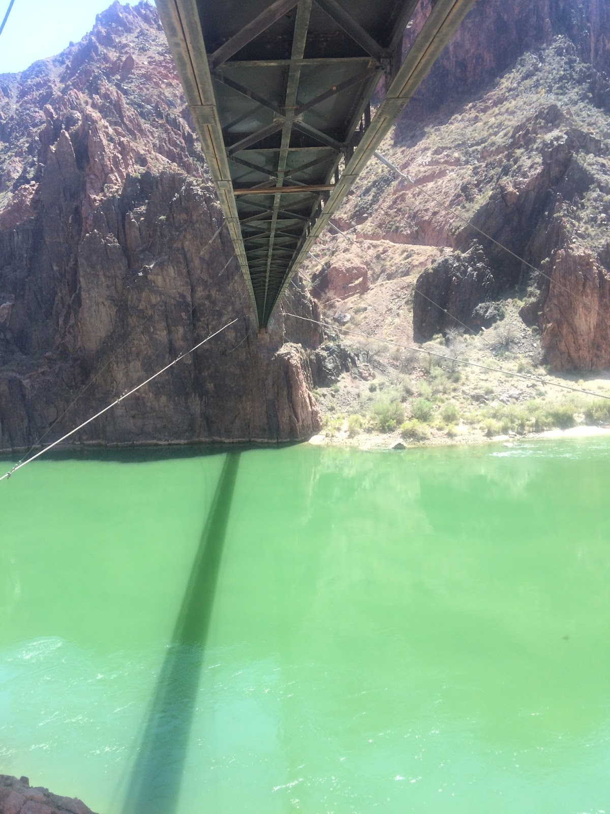
One of the many bridges during the journey 

It was now getting significantly hotter, though it was only maybe 75-80 max. I doused myself as often as I could in stream crossings and water sources, trying to keep cool. My right achilles as well as some chafing were causing me some moderate grief, but I was able to keep a steady pace on the gradual downhill back to Bright Angel Campground. Box Canyon was similar to the Zion Narrows, the next bend has to be the last one, but it never was.

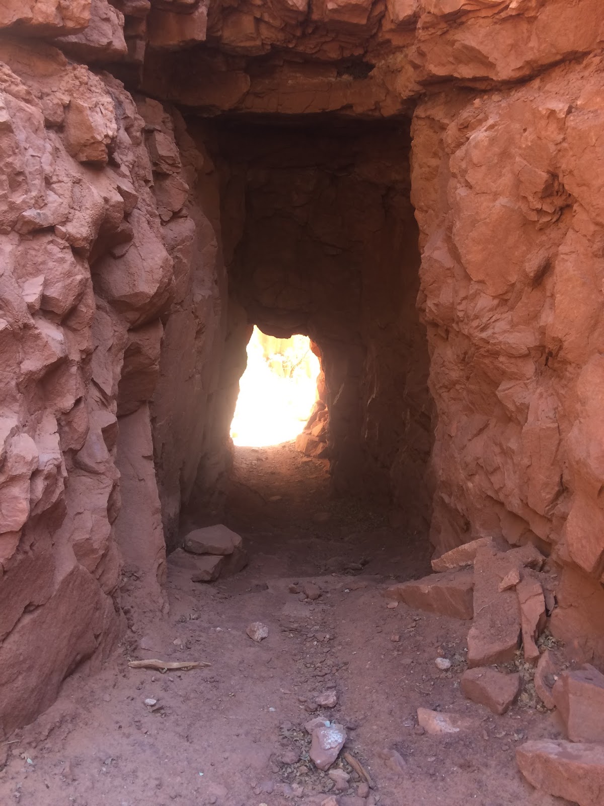
Supai tunnel 

About to cross the Colorado 

I made it back to the river at 7 hours total time, which meant my hopes of breaking 8 hours weren't in the cards as I needed at least 2 hours to get up in my current condition. While I felt ok, I needed some motivation to begin the long climb. I had a little pep talk with myself, ate some gushers, and turned on some tunes. Despite my desire to crush the climb, it crushed me. I tried to keep a steady pace, but it was pretty pathetic. Thousands of stairs, mixed with mule crap. Could have been nutrition, could have just been a long day. I took hope when I started to see overweight and inappropriately dressed tourists on the trail as that meant the trailhead wasn't too much further, but unfortunately those tourists ventured further than I thought they would. I began to worry I wouldn't break 10 hours, but luckily at 9:40 elapsed I was back at my bike at the South Rim, grateful to be done. While certainly not the worst I've ever felt, those last 6 miles were brutal.

Some Cherry Dr Pepper and french fries turned a long drive home into a bearable one. Always good to replenish your body's fuel needs with vital, nutrient rich foods.

I do feel going South to North first is easiest from the perspective that the return journey from Manzanita rest area to the river is largely downhill, which makes running that section later in the day more manageable. That being said, my 2nd R2R time was 1:40 slower than my first. 100% of that result is due to my inability to hike faster than 2 miles/hour up S. Kaibab. Spring seems like a better time than fall due to the lack of folks North of Cottonwood Campground since the North Rim is still closed. I remember lots more people 6-7 years ago when we did it from the North. Spring gives you more of a feeling of solitude, as there are hundred of hikers on S. Kaibab.

Probably won't be back for another double crossing for awhile, but there is no doubt this is a classic!

Sunday, September 17, 2017

The Confluence

Confluence

I was getting frustrated. I'd been wandering around the Grand View Point rim section of the Island in the Sky for the better part of 50 minutes, trying to find the abandoned and so called"Government Trail" that provided the only non-roped descent access through the vertical walls to the White Rim Rd 2000' below. Not to mention within 2 minutes of leaving the parking lot I'd ripped my semi-new green Mojo shorts on a lone tree that looked relatively benign. I was going on some vague directions via map and pictures given by various online sources, the main one being Buzz Burrell's Quad Trek post. They had good pictures from below, but that wasn't helping me up on the rim. I'd thought it be relatively easy to find, seeing as its the only possible option for miles. Finally I decided I needed to go farther out on the rim and sure enough, found it within a few minutes. For others reference, from the Grand View point overlook, follow the 1 mile rim trail for about 5-7 minutes(walking). Bust out to the rim and start walking till you see a cleft in the rim that heads back towards the parking lot(east). This is the entrance.

The goal for today was to descend the Government Trail to the White Rim Rd, run the road to White Crack Campground, take the abandoned White Crack Jeep trail(lots of abandonment on this run) to an old miners camp near Stove Canyon, then cross country it to the confluence overlook of the Green and Colorado Rivers. Easy.

The sneaky route from the Island in the Sky is somewhat similar to the Lady Peak Trail in Zion, a once well used and fantastic route that due to liability has been taken off the NPS propaganda. Probably for good reason. The route is marked with cairns once you get down a little ways. Mostly 3rd with some 4th class terrain winds it way down through the shelves. Pretty amazing little find by whoever did it first. There are a few sections that are sandy and gritty, which make them a little more captivating. No rope work though.

Entrance. You can see the parking lot upper left corner 

Route through the cliff band

Government sponsored foot hold


From Grand View Point Lookout

After only 10 minutes I was down through the cliffs and it looked like a straight shot through a few miles of talus and desert washes to the road. Unfortunately, two smaller cliff bands inhibit the path. The first is easily avoided by heading descenders right. The second is a little more difficult. I was lucky and found a nice little 5.5 downclimb that saved me a bunch of time, as it appeared otherwise a long circumventing to the west would be required.

5.5 climb I found through lower vertical cliff band
After only 40 minutes from the rim(minus my initial wandering) I was running towards white crack. A scenic but rather boring 3-4 miles on the road landed me at the White Crack Campground. From here, old miners have blasted(NPS route all require dynamite) a cleft through the actual White Rim that leads in a very non-direct 5.5 mile fashion out to Stove Canyon, an exit point for those on the Green River prior to the confluence. An old Miners camp is there, with all that's left being a couple old rusted metal beds among other ancient tools. This old jeep rd is now more of a trail, marked by cairns that otherwise would often not be easy to follow as years of overgrowth and rockfall has made it less than buffed out singletrack.
Add caption

Rain allowed for lots of head dunks and free refills

The white crack entrance 
The view from the White Crack Trail. This is why trails are important

They were probably comfy at one point. Miners camp overlooking Green River

From here it was a 2 mile GPS-utilized cross country obstacle course through cactus and slick rock to the confluence overlook.  Various cairns were found intermittently along the journey but I always seem to lose them and had to trust my own instincts(not very effective). Eventually after 3.5 hours from leaving the rim I arrived at my destination. It was beautiful, but somewhat anticlimatic as both rivers are pretty ugly, a poo brown. Not exactly majestic. However, the fact that I was 16 miles from the nearest paved road in a very inaccessible part of the park made for a very calm and peaceful, but serious experience. A broken leg out here wouldn't be a good idea.

Reversing the route was much easier as all the route finding had already been done. I shaved off a few miles and at some time despite being tired and having the steep climb back up to the rim. All in all it was a great day in what I often consider my favorite national park. 32 miles with 5600' of vert.

Canyonlands.

Monument Basin with standing rock visible